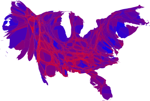
One way to improve the map and reveal more nuance in the vote is to use not just two colors, red and blue, but to use red, blue, and shades of purple in between to indicate percentages of votes.
Then, adjust the map for population density (rather than geographic area).
No comments:
Post a Comment